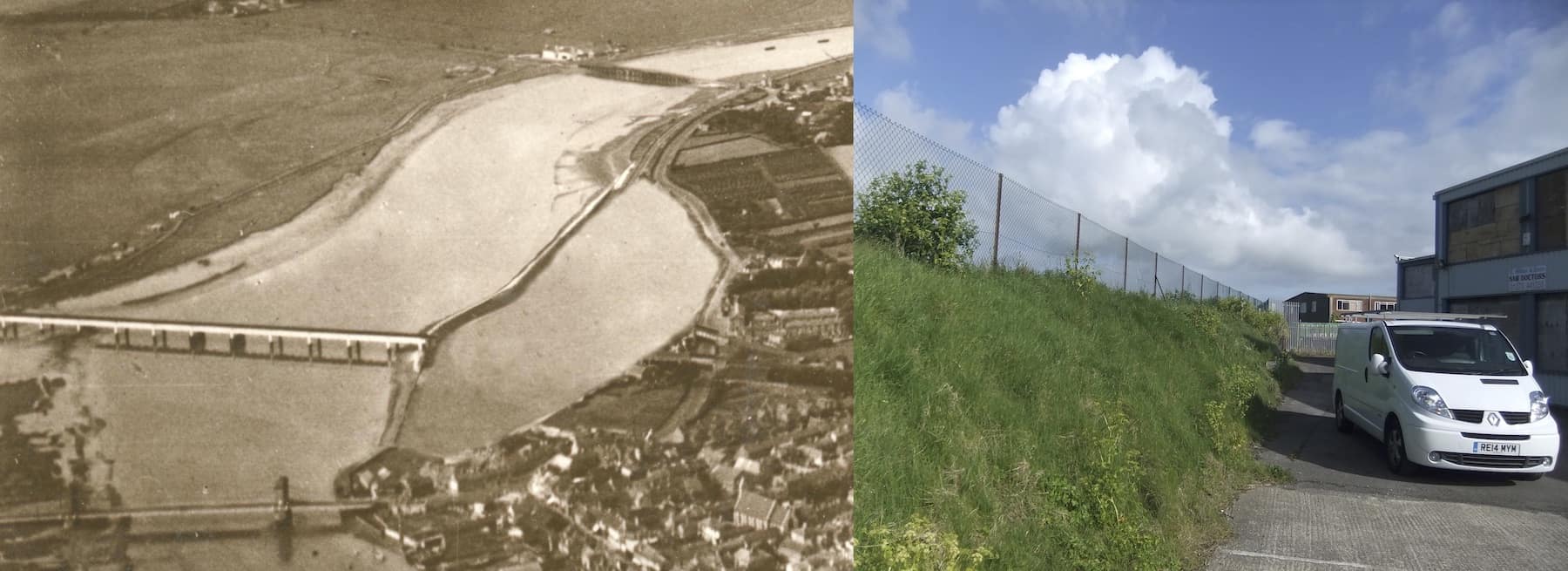
Back in the 1780’s today’s river bank at Ropetackle was thrown up to reclaim land and reduce flooding. In 1813 though the enterprising owner of the land between the bank and the Old Shoreham Road filled it up again by breaking through the bank at the southern end to allow tidal ingress and egress then offered it for sale as a tidemill. The mill pond is recorded in Clegram’s map of 1815 but after the railway came through only the lower half seems to have survived as a tidal pond into the 1870’s but there is no record of an actual tidemill to utilise the flow ever being constructed.
This photo-shopped aerial photo with the railway viaduct removed gives a good idea of the original size of the pond which together with the photo of the height of the bank/depth of the water gives an indication of the considerable volume of water it would have held.


