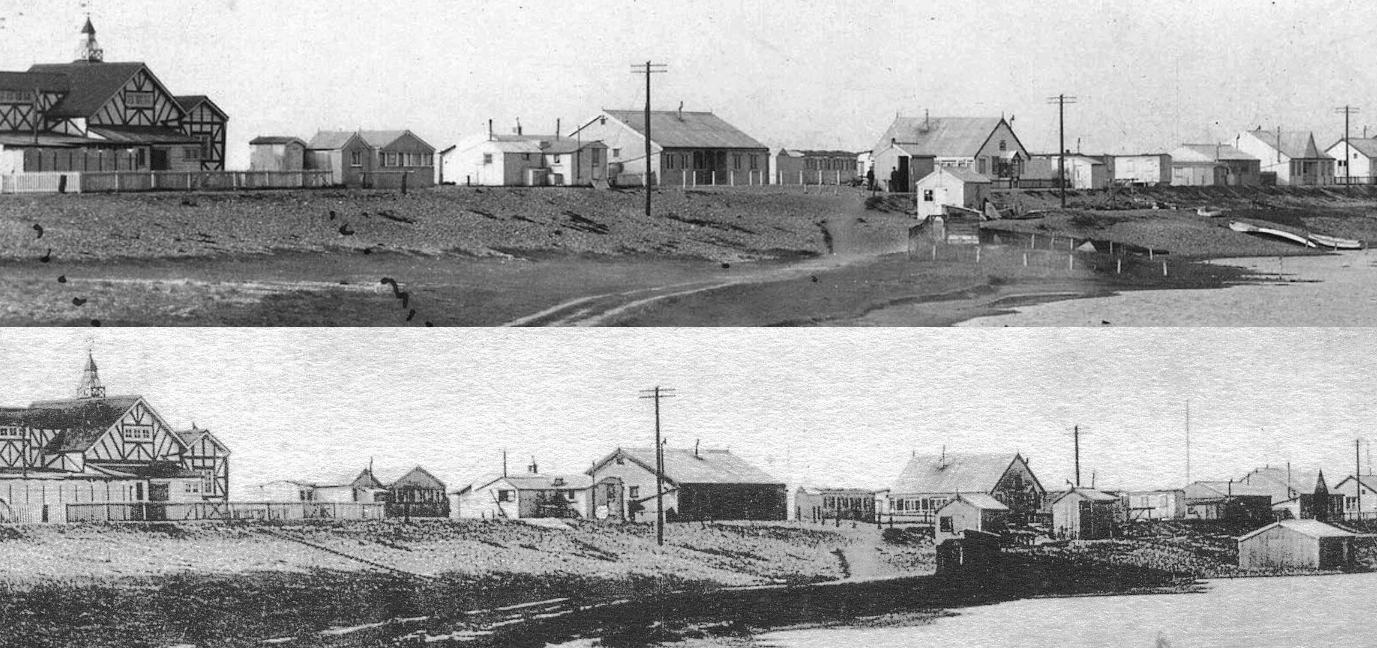
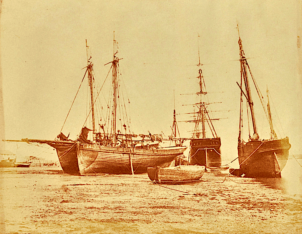
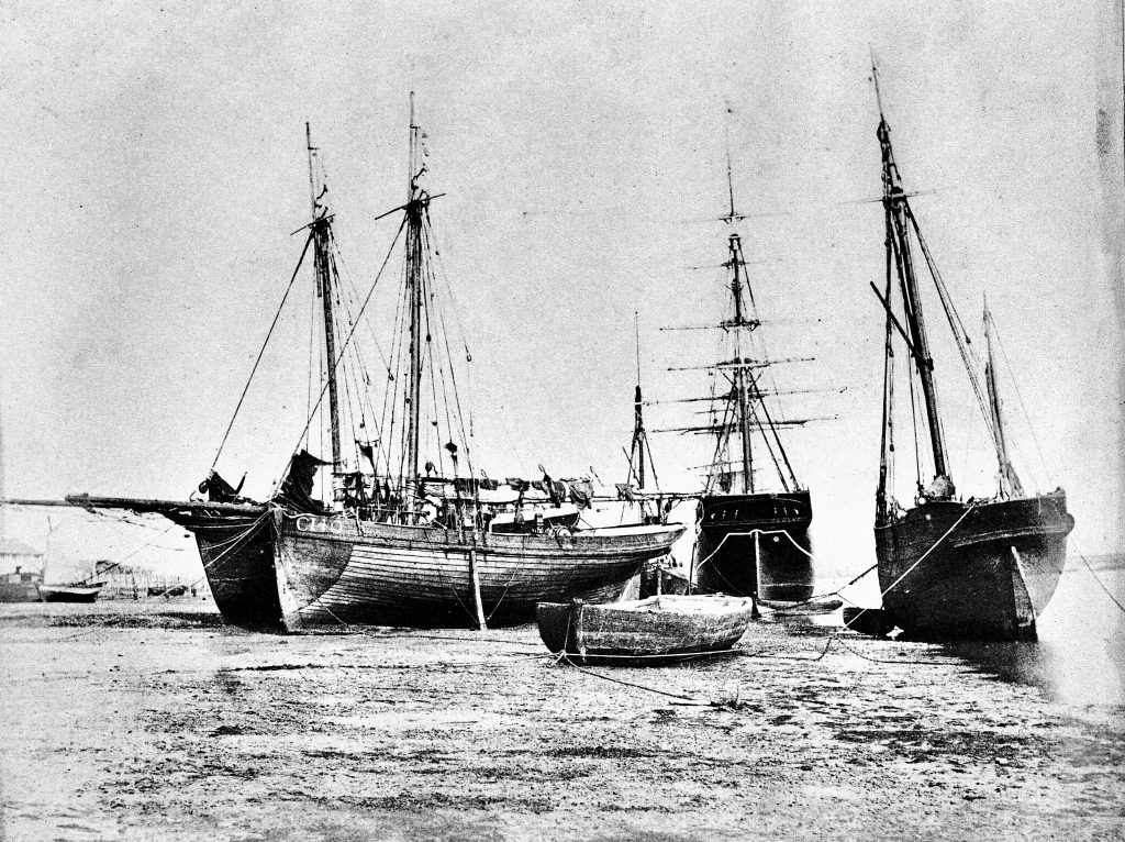
I’d always thought these two photos were identical (apart from the quality) until I looked more closely. There can’t be more than a few weeks/months difference between the two.
When the Romans came
We know our coast line over the centuries has changed a lot. Eroded in some places – e.g., locally the loss of the village of Pende to the sea – but built up in others as evidenced by the spit created for Shoreham beach. Generally though it seems for the majority of the south since Roman times the coast has been eroded but by how much?
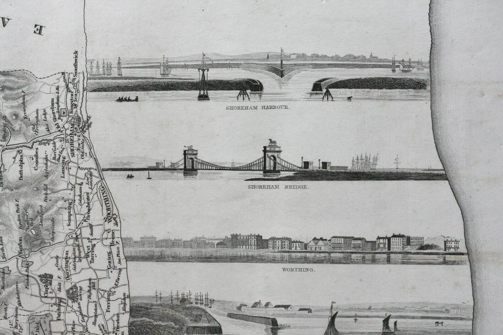
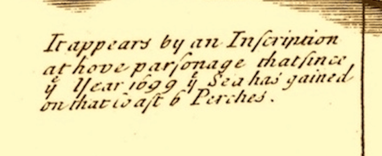
I’m sure erosion doesn’t happen at a constant rate but there is a indication in our 1724 Phillimore Margary map that has the attached notation entered just below Hove. It suggests that six perches were lost in 25 years. I’ve forgotten, perhaps never knew, the old surveying measurements so had to look up perches but anyway six of them apparently equate to 33 yards (still can’t be bothered with metric measurements) and with 1,760 yards to a mile (funny how some numbers stick in your mind and that one has) the loss at a constant rate would take 1,333 years to lose a mile.
I’ve never been good at sums and bet I’m wrong again but if for once I’m not then it seems when the Romans came our coast may have been a mile or two further out.
Was Shoreham Millwright’s Invention fitted to Lancing Windmill?
Shoreham millwright James Holloway is particularly well known for having invented the screw brake, a system that enabled the vanes of windmills to be slowed down gradually, thereby avoiding any damage caused by more sudden stops that occurred on conventionally operated mills.
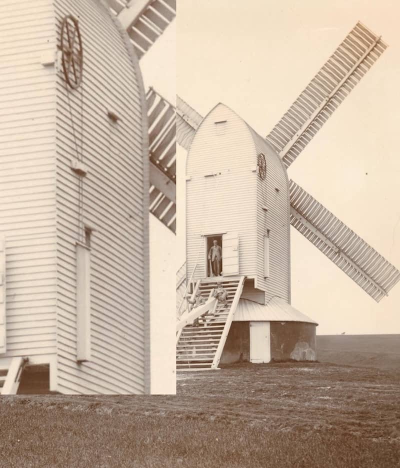
He fitted one of his screw brakes on West Blatchington Mill (amongst others) but I had no record of him ever working on Lancing Mill. This is detail from a photo of the Lancing mill – is it part of the machinery to slow the vanes in which case I assume the chances are it was Holloway that fitted it?
http://www.shorehambysea.com/mills-millers-millwrights/
Not Holloway’s system apparently but a fascinating response from Peter James of the Sussex Mills Group:-
The wheel you can see at the back right of the buck is the ‘Striking Chain Wheel’ around which, there is a chain that goes down into a weight box (the long capped box below). There would have been access to this box within the mill and the miller would have a hung a weight on the chain. The striking wheel would be geared to the striking rod, probably via a rack and pinion. The striking rod ran through the centre of the windshaft and connected to a cast iron cross at the front. Linkages from this cross would connect all of the shutters in the sails. The linkages together with the cross are called ‘the spider’.
The miller would hang a weight on the chain, which would in effect hold the shutters closed against the strength of the wind. If the wind became too strong the shutters would open against this weight and ‘spill’ the wind, thus slowing down. Hence this is a form of automatic control – different weights could be used depending on the strength of the wind.
Details in photos
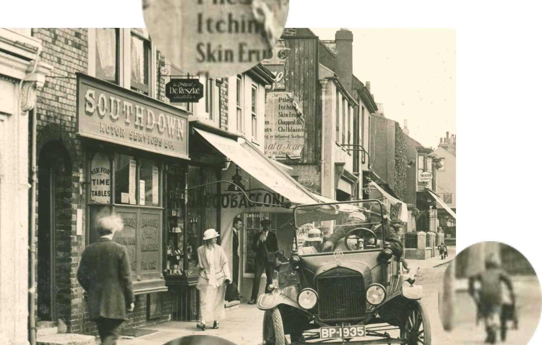
Can’t see that this has been posted before but it’s a small part of a larger photo and one of my favourites for detail:-
Passer by exhaling smoke from his fag,
Impatient man in car (and, yes, it’s a Model T Ford) with noisy kids thinking ‘How much longer – is she buying the bloody place!’
Automobile Association bonnet badge (blimey, do you remember those!)
Lad with wheelbarrow imagining how pleased his Mum will be when he brings fresh horse manure for the garden back through the house.
Evidence of an itchy-bum outbreak in Shoreham (that’s lowered the tone a bit!)
A cautionary tale – Bungalow Town
Not of much interest to many perhaps but this cautionary note is for those researching Bungalow Town property locations:-
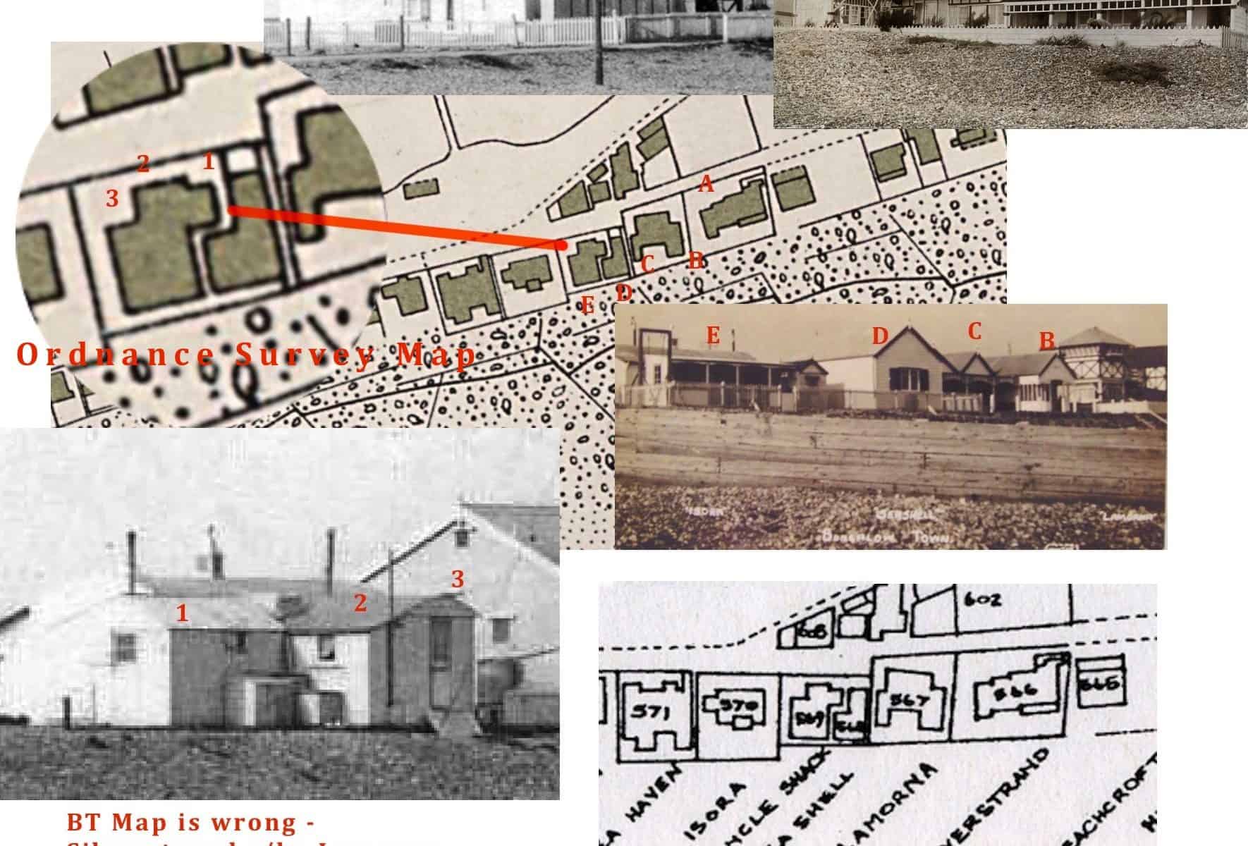
For many years now it has been known that the 1930’s Bungalow Town property map (in Shoreham Library and on this website) to be unclear in places as regards the rather indistinct way some of the bungalow names are noted against the property footprints. Nevertheless the map remains a good indication of where most of the bungalows were, in fact many have been proved correct through old photographs (e.g., name signs on the walls of the buildings etc.,).
One glaringly obvious inaccuracy though has to be the misnaming of the well known ‘La Morna’ (1) as ‘Silverstrand.’ The attached illustration footprint of property number 566 clearly matches ‘La Morna’ as do the features indicated in the photographs of the neighbouring properties. Obviously this has the effect of shunting the order of names on by one but due to the indistinct labelling the names that appear on the map some properties later continue to match correctly against proven bungalow locations.
(1) A high resolution copy of the ‘La Morna’ photo shows a lifebelt on the wall with the building’s name on it.
(2) The property map is here http://www.shorehambysea.com/bungalow-town-property-map-1935/
Air Training Corps
Written by Gerry White
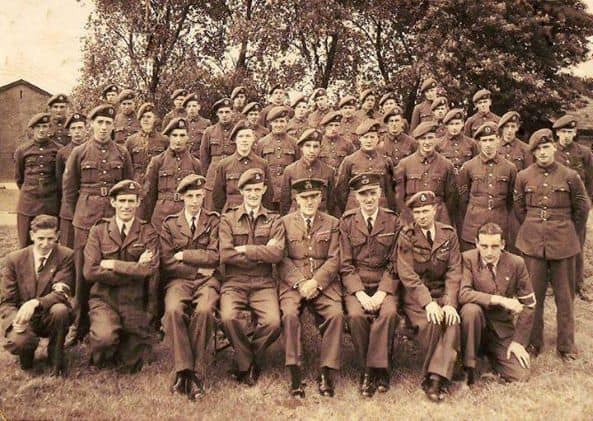
No 1440 squadron Air training Corps ATC ,was founded at Middle Road School in 1941, At wars end in 1946 the Squadron was given premises at the Dome on the Airport, there were a number of associated wooden Huts used as lecture rooms , When I joined in 1951, the meetings were Tues and Thurs 7 til 9 30 pm. The Commanding Officer was Flt Lt Sidney Cole a wartime RAF Officer Flight Commanders were Flt Lt Kenneth Winstone,Fg Off Norman Finch and Fg Off Kenneth Guest , the Squadron had three flights Shoreham Lancing and Steyning. at that time membership was approximately 60 , an Adult Warrant Officer Wilfred Stephenson and Civilian Instructors Gerald Woolvern Alan Morgan and Thomas Pollington , Lectures on dress deportment, and drill were given , the squadron had approx. 25 .303 Lee Enfield Rifles of WW1 vintage. The Squadron members were taught Morse Code, basic Engine function , and map reading , hobbyists took part in model making on Sunday Mornings as did the Drum and Bugle Band ,The Squadron took part in Annual Summer Camps held at RAF Stations for one week duration each cadet was given a flight in service aircraft and fired on the weapons range ,The joining age was 13 years leaving at age 18.
The View – King’s Drive
A much damaged photo but perhaps the only one of that subject that still survives. ‘The View’ stood near today’s junction of Woodard’s View with King’s Drive.
Oldest Shoreham photo?
An atmospheric photo that oozes antiquity! The title is ‘Smacks and Vessels on the Beach at Shoreham’ taken by Samuel Buckle, a British photographer 1808 – 1860 and the photo was taken in 1853. Just about the oldest Shoreham photo I’ve seen.
(From the J Paul Getty Museum Collection – copyright)
Getty Museum: Smacks and Vessels on the Beach at Shoreham
Tracing photographs
From right to left, anti-clockwise:- A newspaper cutting of an otherwise anonymous group and Shoreham location has ‘Standen Family’ written on it. A check through our street directories shows the Standen Brothers at Southdown Nurseries in Mill Lane (where the greenhouses are in the aerial photograph). A 1950’s parade of Morris dancers provides a closer view of the nursery just beyond the lodge to the cemetery and lastly a view of the entrance and shop in the 1930’s.
The Lindupp brothers
The story of Reuben Lindupp is included in ‘More Shoreham Characters’ on this website http://www.shorehambysea.com/more-shoreham-characters/ Susan O’Leary has sent us this link to her fascinating story of Reuben’s brother Harry who left Shoreham to become one of the early pioneers in Australia. Well researched and beautifully illustrated with some stunning photos – well worth a read. Thank you Susan.
http://www.historysnoop.com/henry-harry-lindupp-1827-1905