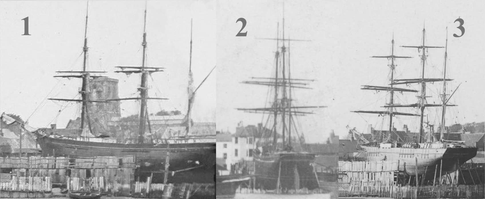
Some on the forum have already discussed this but thought it might be worth checking other people’s opinions. Are these ships all the same vessel? The masts, lines and form of the two images 1 & 2 certainly appear to match. Photo 3 is perhaps a little doubtful when looking at the ships alongside each other. Is it the lighting on the ship’s side of that makes it look different to the paintwork on the previous two photos? The upper lines/shape of the vessel also seem to be more straight and level but maybe this is an illusion as the rigging fixings to the hull in 1 and 3 do appear to be similar. What do you think?
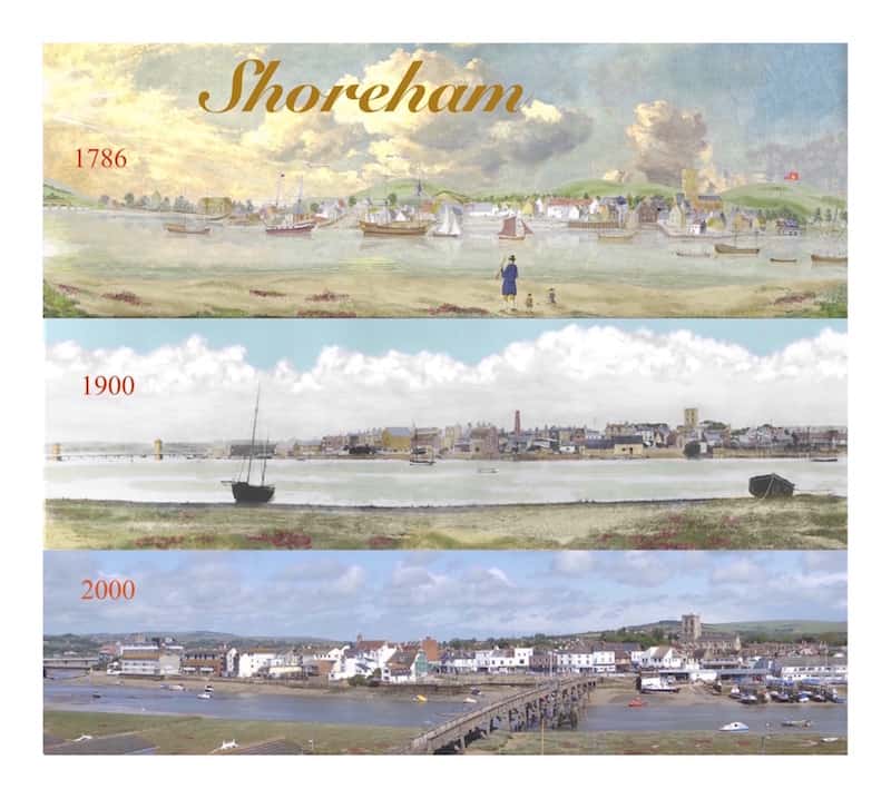
Panorama through the ages
No, not a Christmas card but a copy of a group of Shoreham panoramas over the centuries that we put together before the latest footbridge was built – all it needs now is for some kind soul to take a ‘today’ photo from the top of Pacific Court to update it.
Coastguard Cottages Southwick
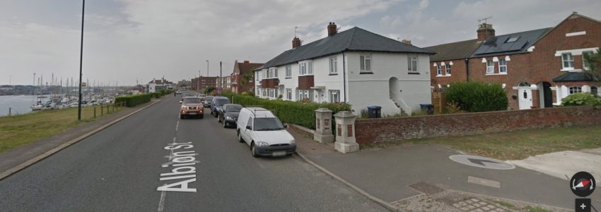
Our local Coastguard Service was originally located in the cottages on the beach at the end of Ferry Road but by the early 1900’s were relocated to Kingston then soon after to purpose built accommodation at Southwick. Sad to say the view of them there is now obscured by later buildings incredibly permitted to be erected in front of all of them except for the Chief Officer’s house that fronts on to the main road.
This photo of the cottages as they once appeared is a composite produced jointly with Neil De Ville.
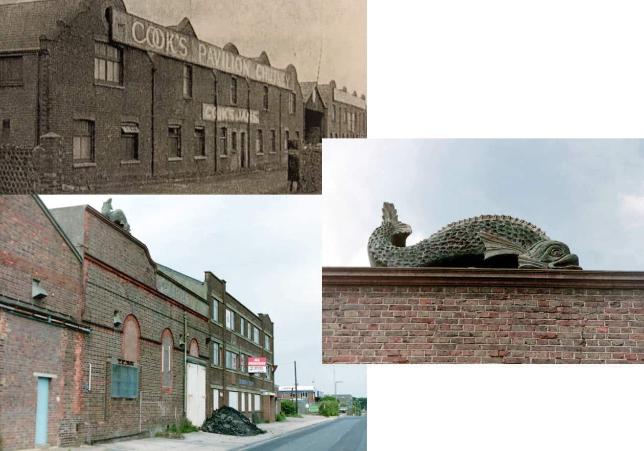
Cooks Jam Factory
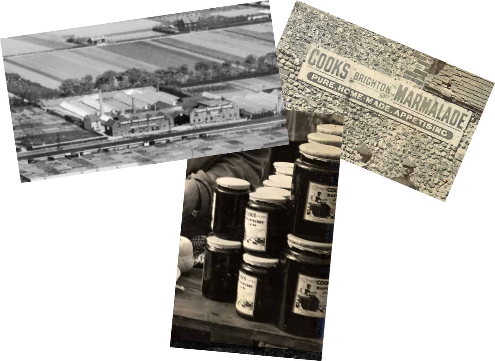
Cooks was a large concern with a factory in Dolphin Road that once backed on to fields in Kingston, now completely built over, where much of the fruit for its jams was grown. Apart from hand drawn advertisements the only photo I’ve seen of their products is this detail from a larger image showing jars of their raspberry and strawberry jams.
 These photos give some idea of the extent of the fruit nurseries above the factory and those on the right confirm what you say Lihpsir. Top right shows what are probably fruit bushes being grown between the Old Shoreham Road and Connaught Avenue. With Buckingham Park in the distance the photo below right shows similar vegetation all the way up to Southlands and the Upper Shoreham Road.
Continue reading “Cooks Jam Factory”
Swiss Cottage pub
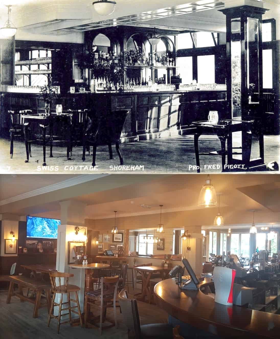
An unusual shot of the Swiss Cottage bar in the 1930’s when Fred Pigott was landlord there and how it looks today. This reminds me that some years ago we were given a small collection of photos of the Clarke family (not on display) who were the previous landlords and this is one of theirs in the pub’s back garden that was, of course, once part of the popular Swiss Gardens of Victorian times.
Continue reading “Swiss Cottage pub”Tales from postcards, returned
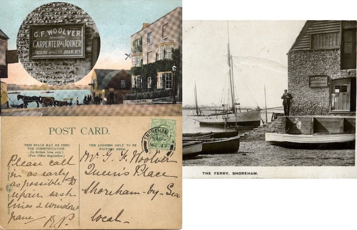
One hundred years ago the postal service was so good a letter sent to a Shoreham address in the morning from a person setting out from London would often arrive before the sender arrived home. Same day delivery also prompted the use of postcards for urgent messages. This one was used by the owner of Dolphin Chambers in 1911 to send to George Woolver asking him to repair one of the windows. It was addressed to him at his home address in Queens Place which is a bit strange as he had his workshop right next door to the Chambers at that time!
Airport Tower
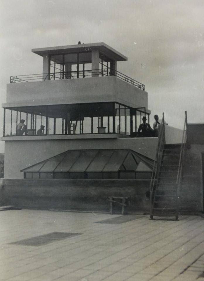
…. when newly built. How on earth did those window surrounds hold it up?
Panoramas of Shoreham
– Albion Place looking east to The Duke of Wellington and Tarmount beyond
– The town from the church tower circa 1920. Due to it’s size this has to be a much reduced copy and as yet is not totally finished.
(click on the image to enlarge it )
Longcroft: a history in postcards
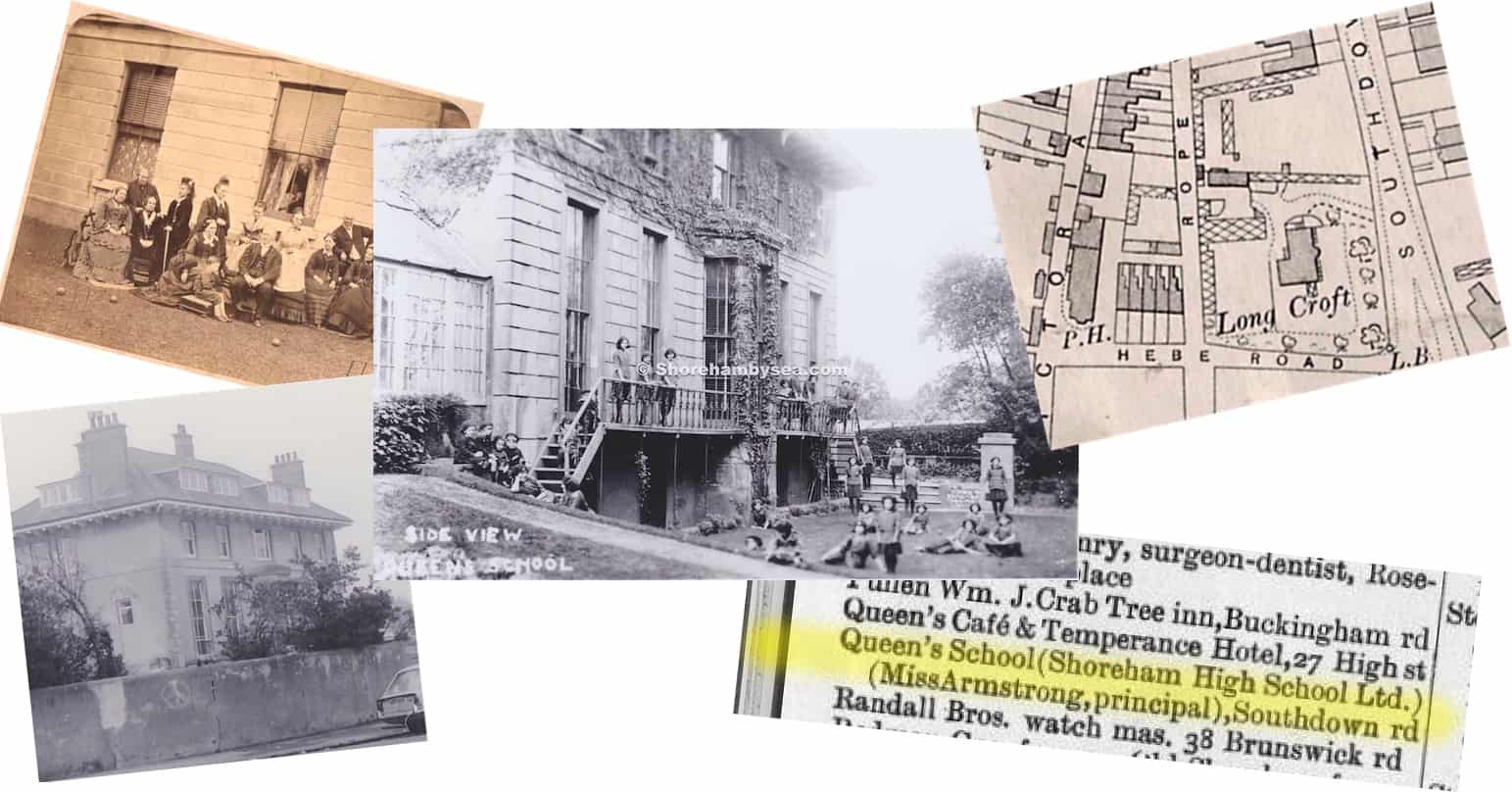
J.B.Balley, ship builder and creator of Swiss Gardens built a grand house for himself in Longcroft field on the corner of Hebe and Southdown roads then later sold both to Edward Goodchild (previously landlord of Brunswick Arms) in the early 1860’s. As the main photo shows it became Queens School for girls and appears as such in the directories between 1920 and the start of WW2. The centre bay window column was added after 1898 – the rest of the houses up Southdown Road are out of shot to the right. You can just make out the top of the greenhouse shown on the 1912 map.
Continue reading “Longcroft: a history in postcards”Old Blockade Coastguard cottages
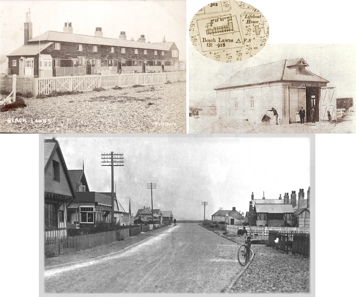
The old Blockade /Coastguard cottages and the lifeboat house stood on the beach at the junction of Beach Road with Ferry Road. The postcard (below) from Howard Porter shows a very unusual rear aspect of it on the right with the lifeboat house just beyond it.
